THE GRAND BAYWAY MOVES AHEAD
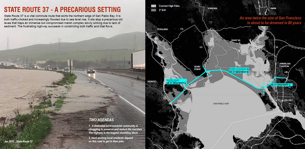
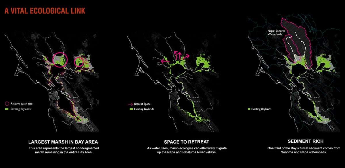
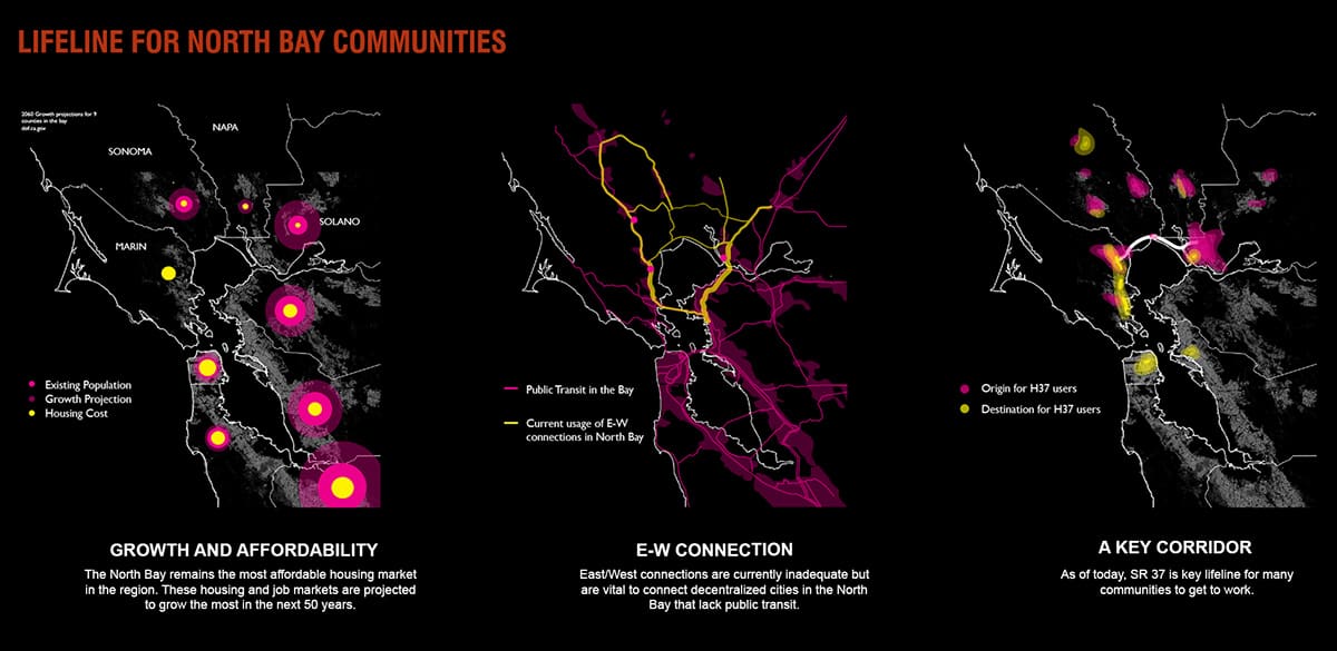
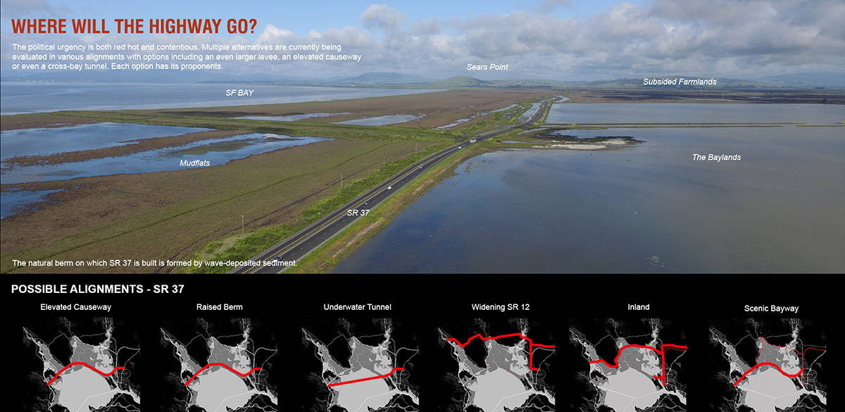
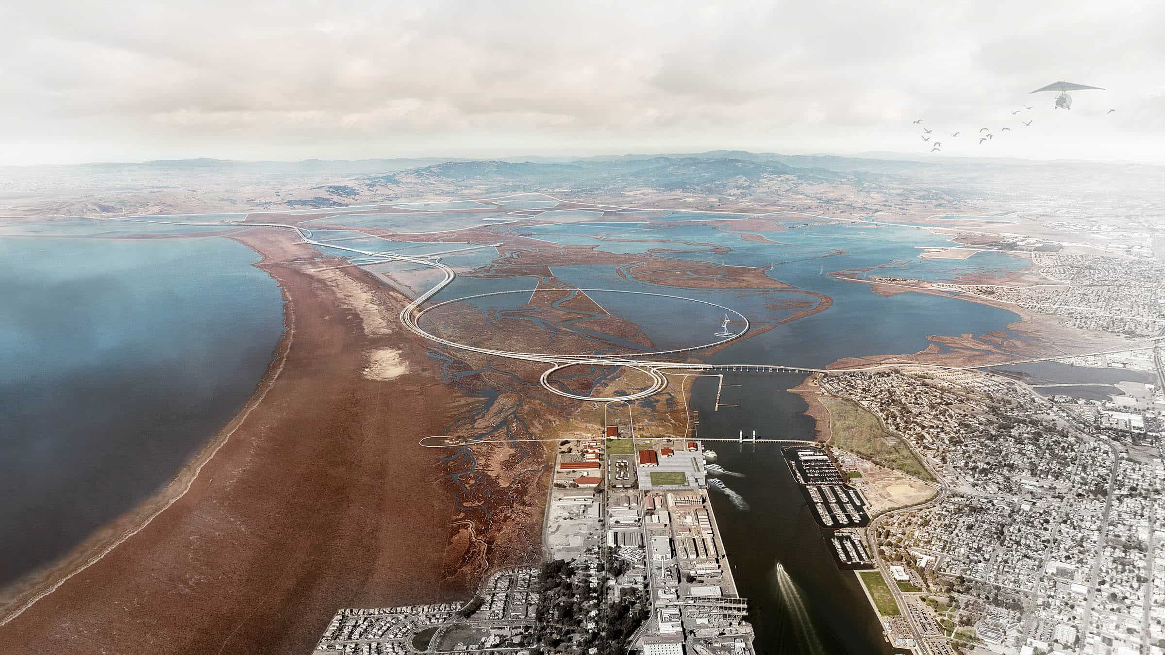
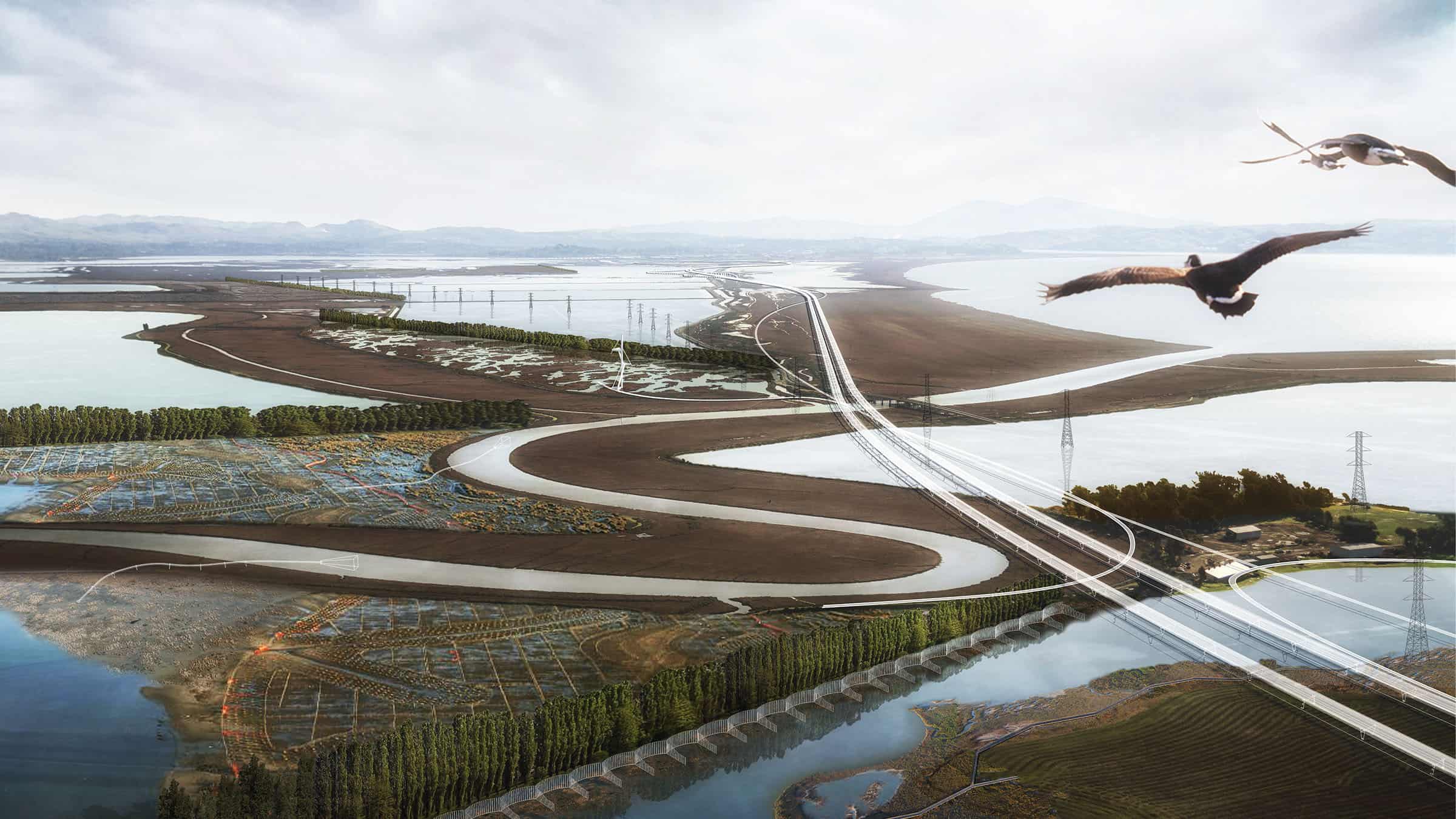
The Common Ground Team led by TLS Landscape Architecture presented a vision for a “Grand Bayway” at the Resilient by Design Challenge in San Francisco, on May 17th. The proposal looked at a resilient future for flood-threatened and congested State Route 37 connecting the northern edge of San Francisco Bay as well as adjacent tidal complexes and restored marshes.
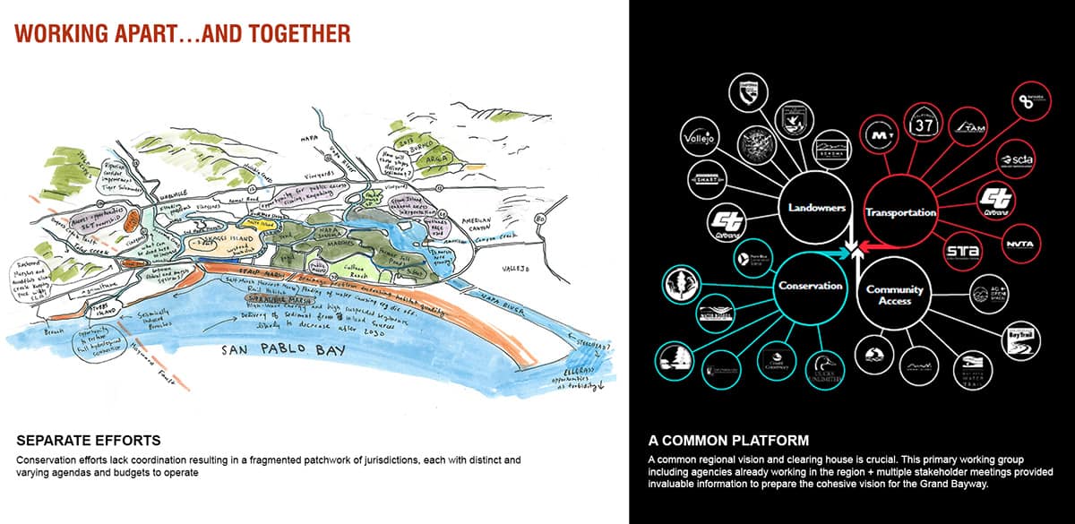
In 2017, on behalf of BARC, MTC submitted a successful a Caltrans SB1 Climate Adaptation grant application to further advance concepts developed for SR37 and the surrounding area during the Resilient by Design Challenge Bay Area Challenge (RBD). An SB1 Project Management Team (SB1PMT), managed by BARC staff, with representation from MTC/ABAG, BCDC, Caltrans and the State Coastal Conservancy (SCC) selected The Grand Bayway proposal by team Common Ground for further study to advance important goals related to mobility, public access and environmental education within the San Pablo Baylands, based on concepts identified by the Common Ground team during the RBD Challenge.
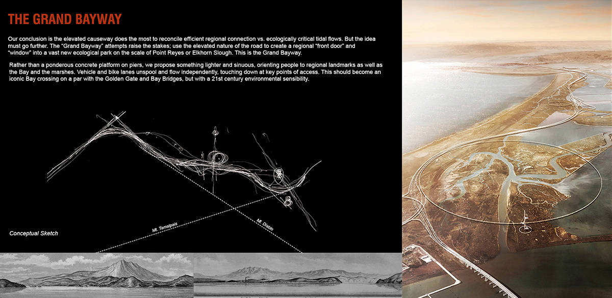
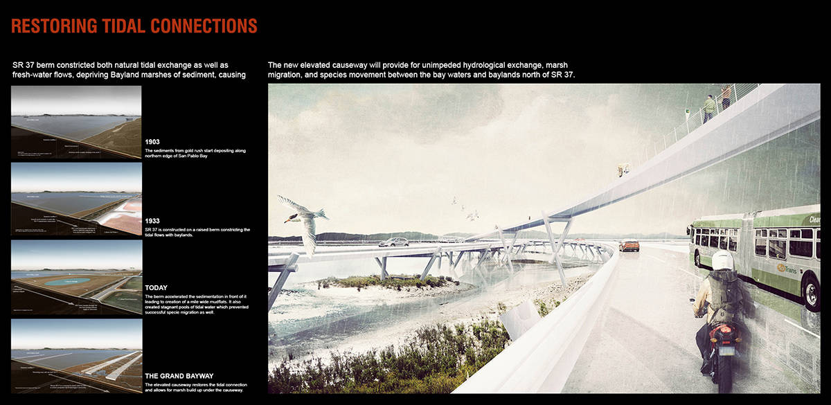
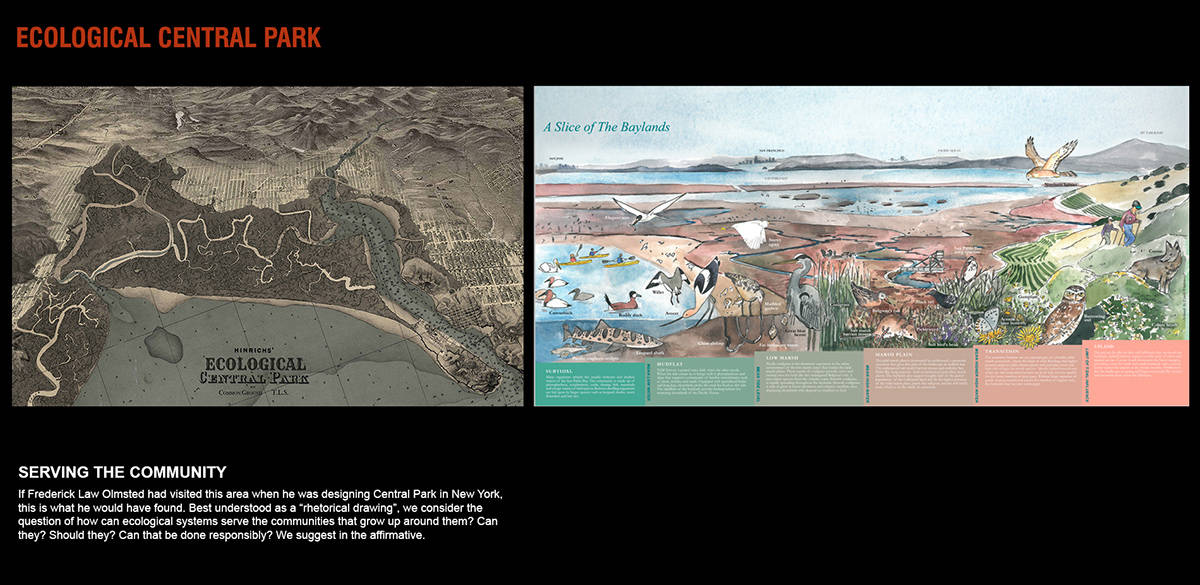
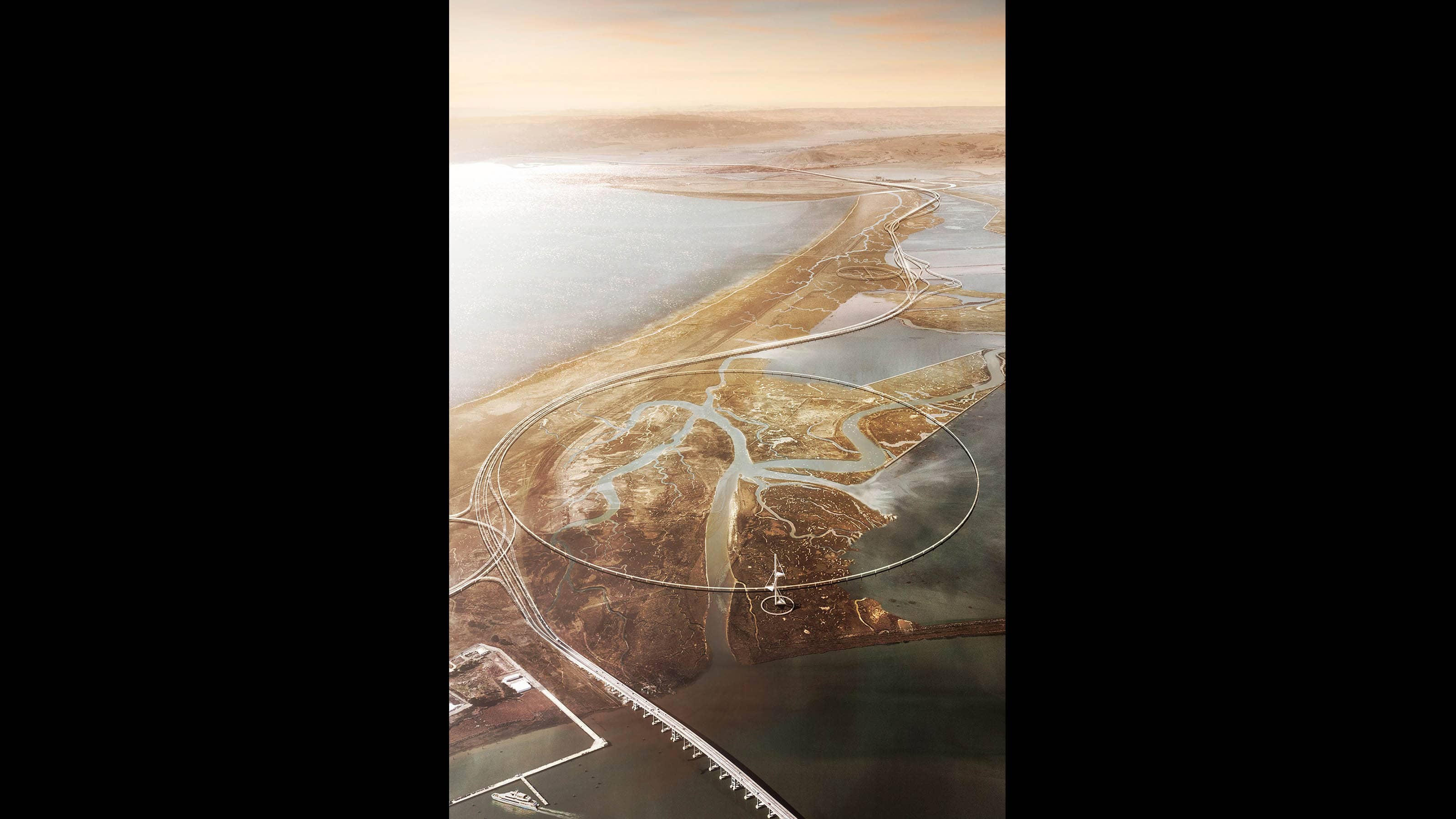
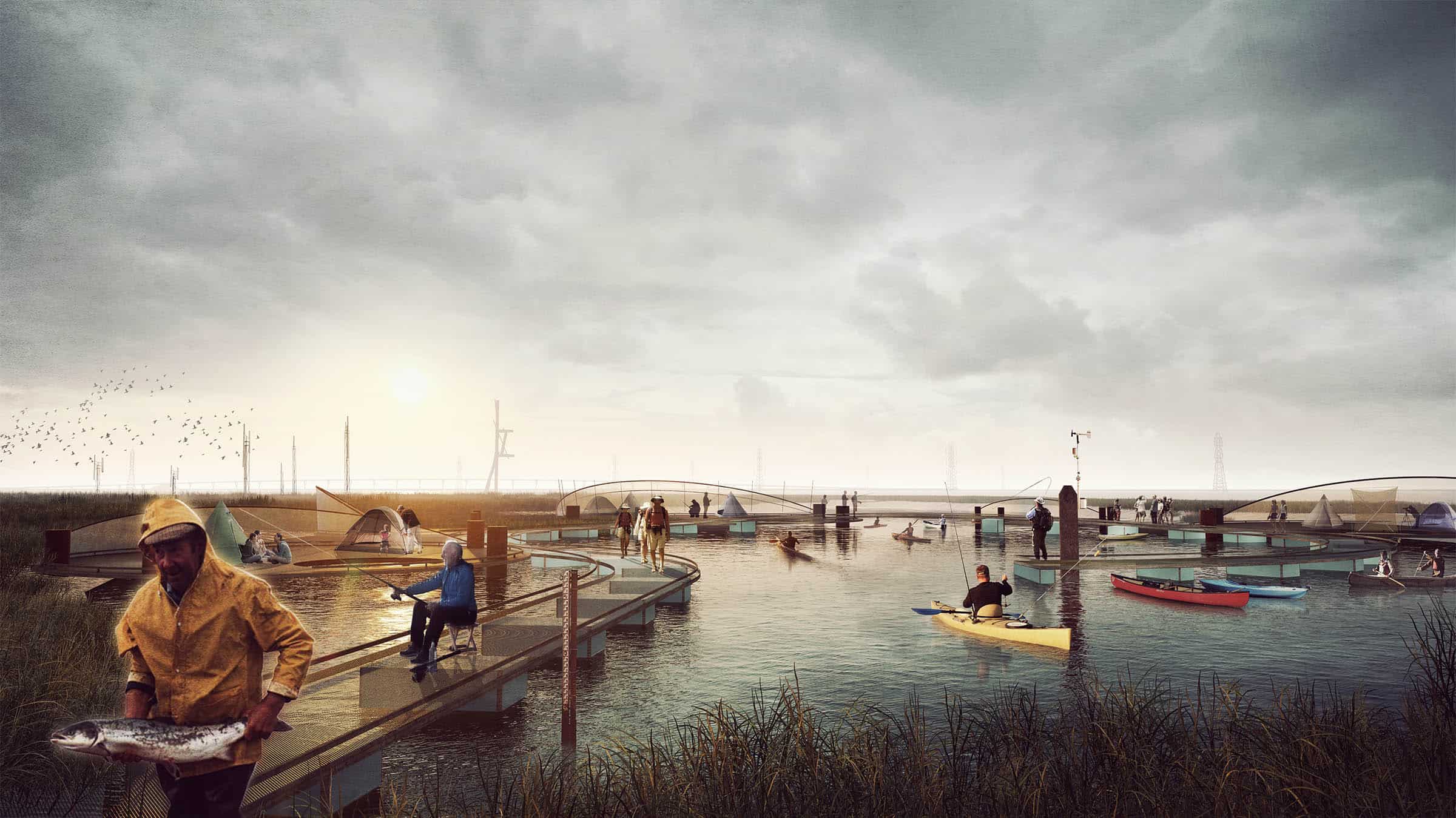
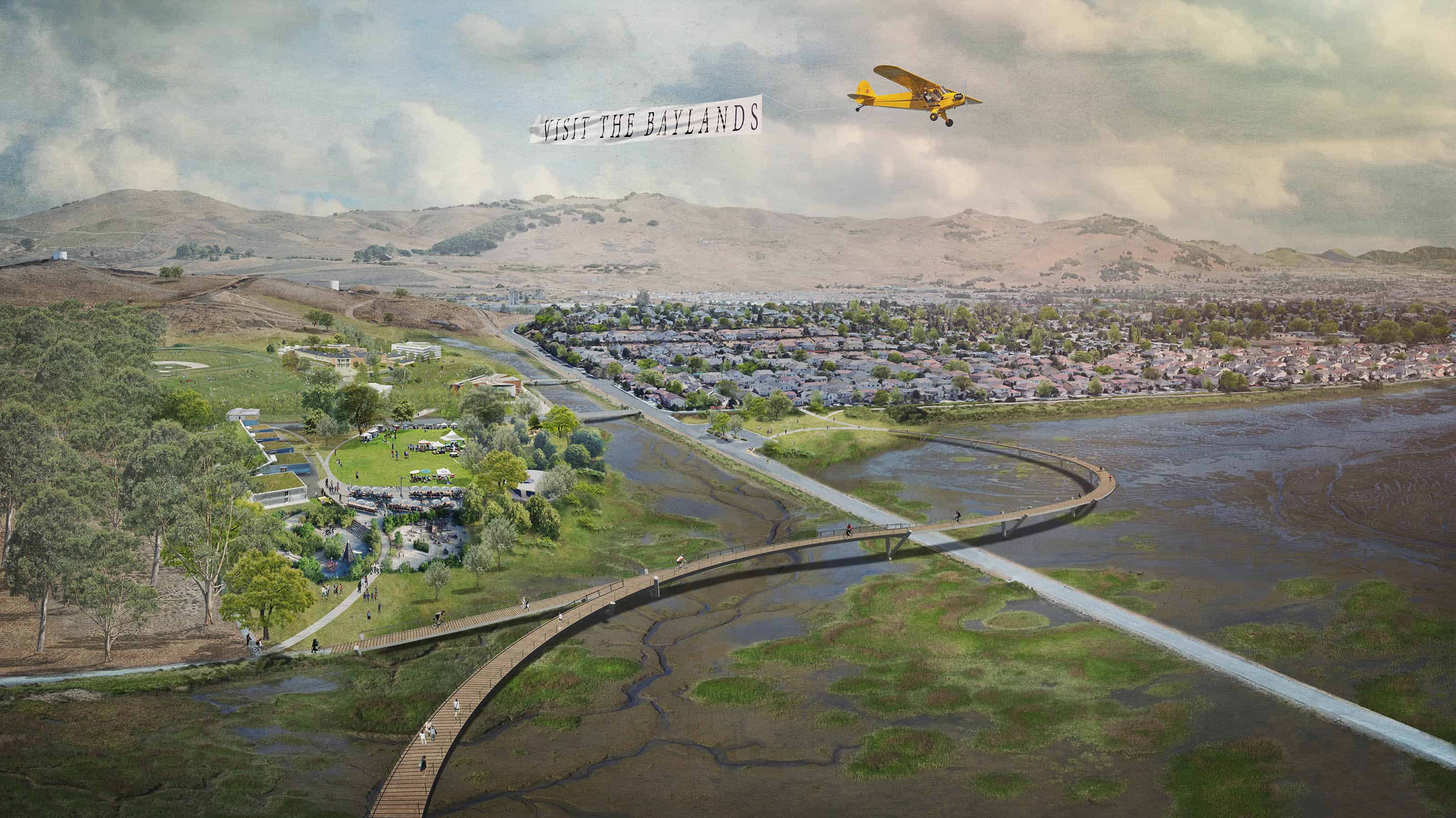
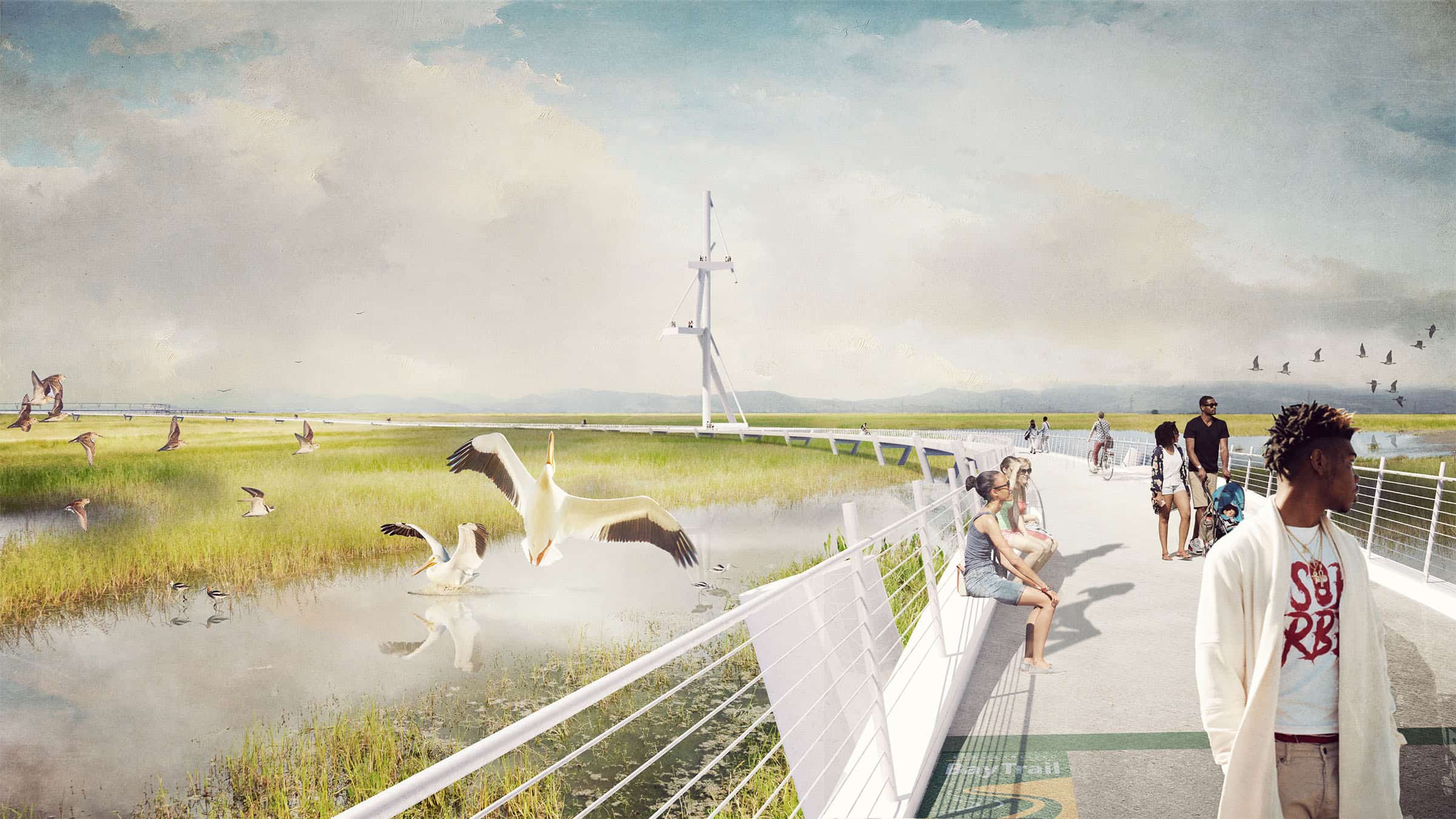
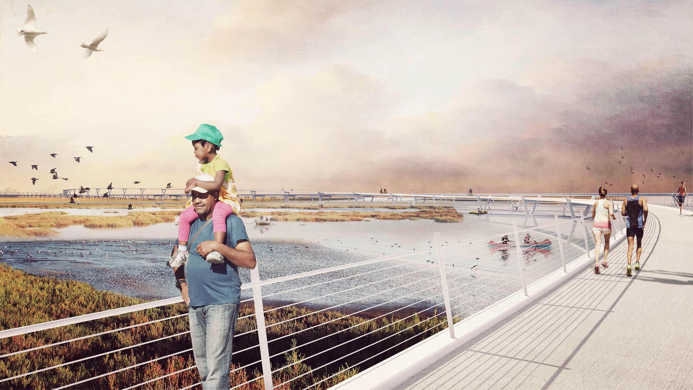
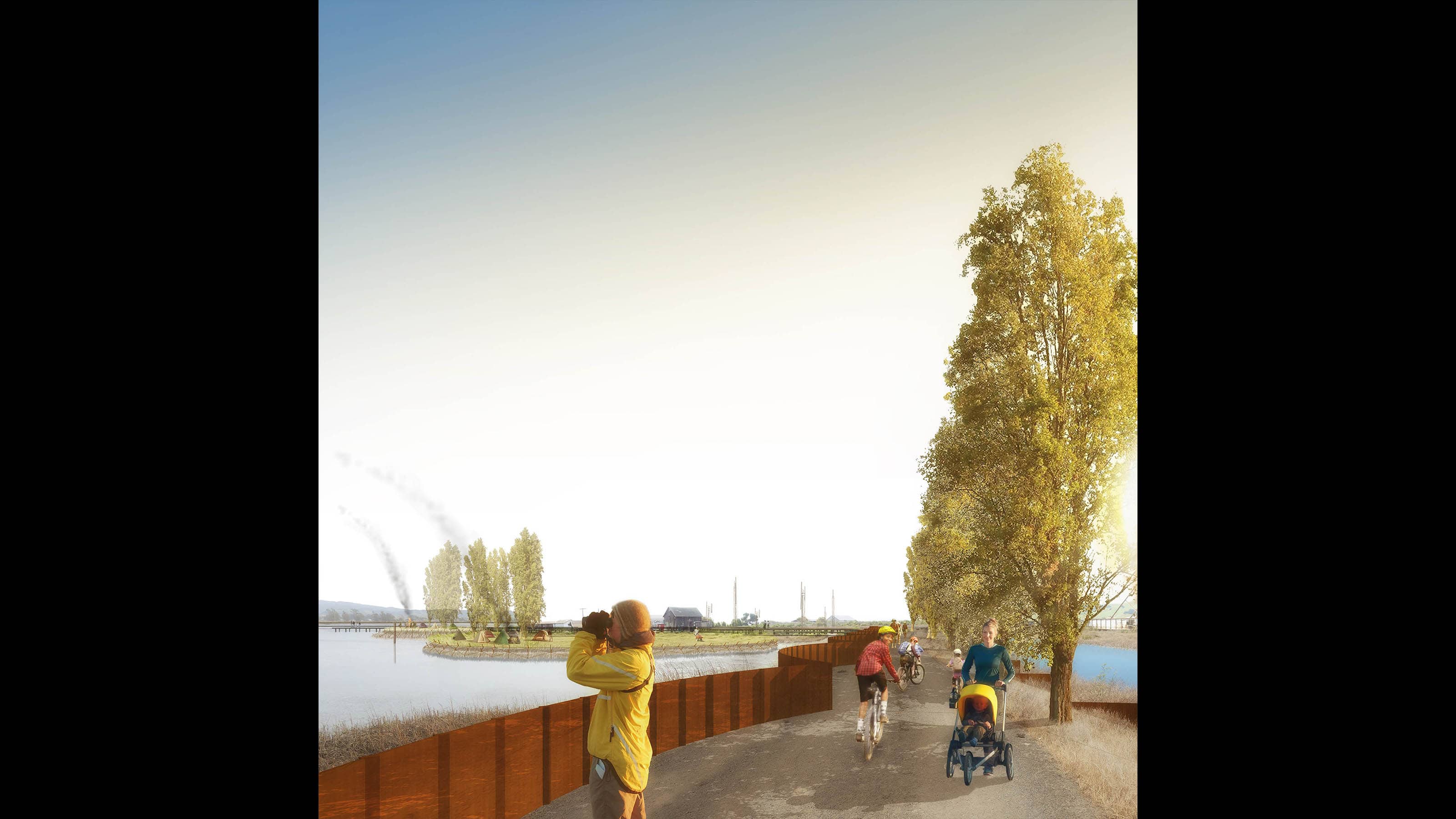
The vision presented early in May 2018 proposed to resolve the transportation problem of Highway 37 by designing a scenic causeway elevated on columns 20 feet high, allowing tidal flows and marsh migration to return to their natural condition. These same principles operate whether in the current southern alignment or moved to an alternative northern alignment, skirting the edge of stable uplands. The causeway is designed with the same ambition and flair as other iconic bay crossings but based on 21st century sensibilities for the natural environment and diverse transit types, not just vehicles. Rather than broad concrete platforms on a forest of columns, this design is based on the principles of scenic byway design, curving to open views over the bay and marshes and oriented to natural landmarks. Lane directions as well as the Bay Trail are “unspooled” and flow independently like the sloughs they traverse, creating access to open space below. This level of investment in design and visibility for an ecological “Central Park” will return major value for the region, its identity, and its future.
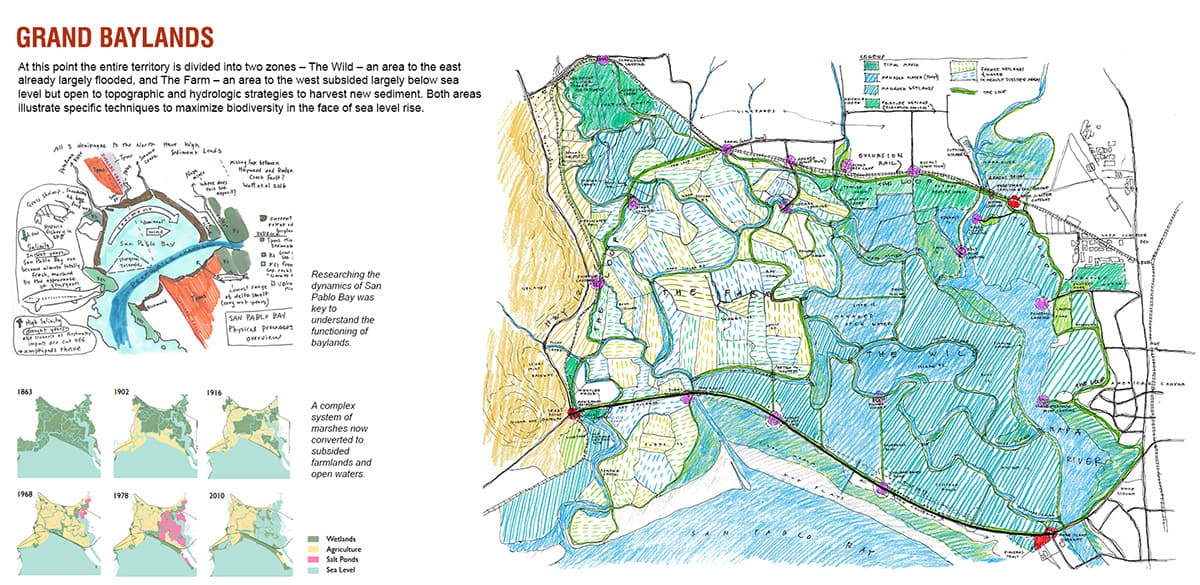
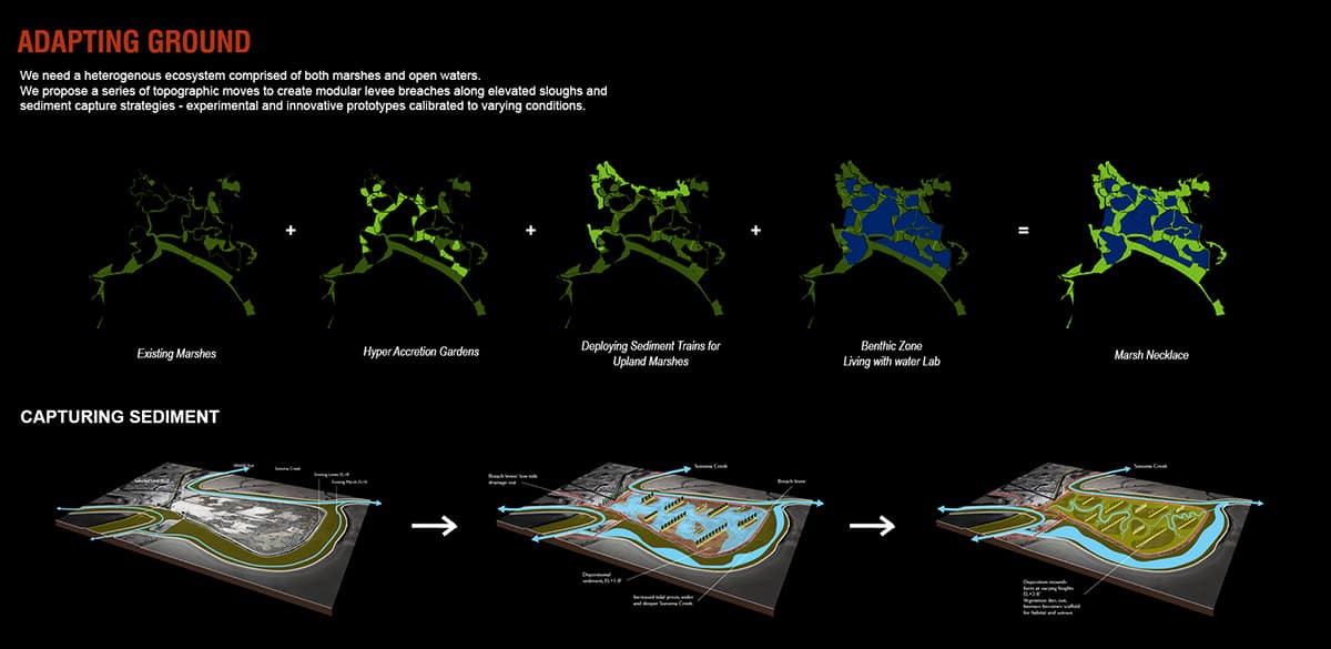
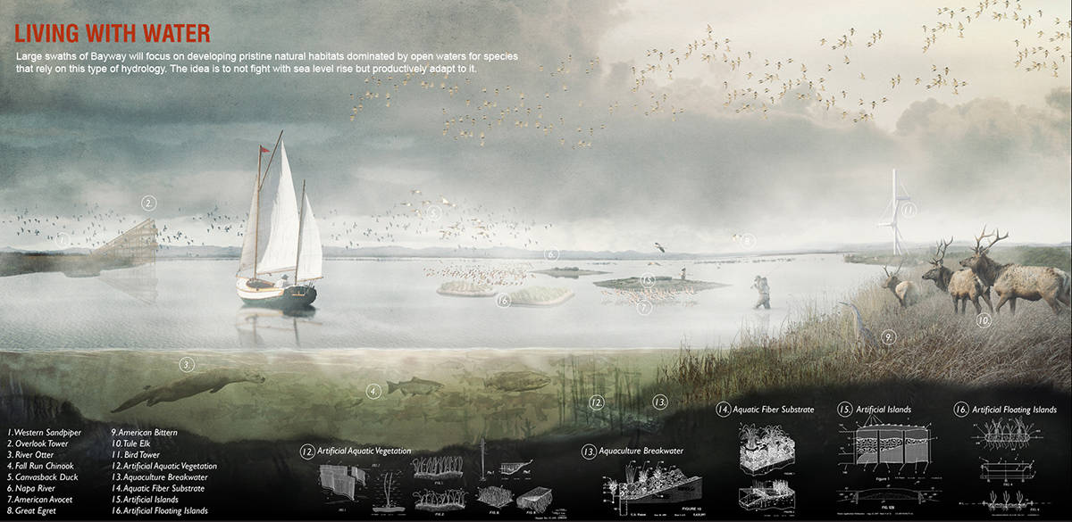
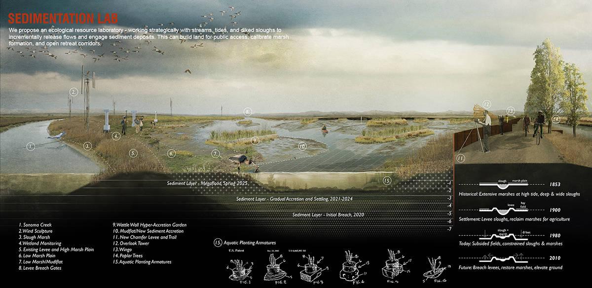
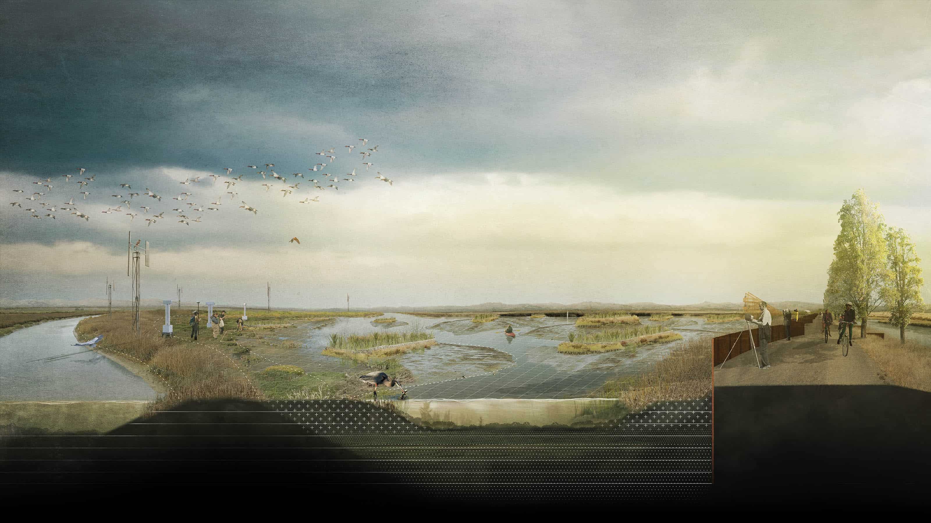
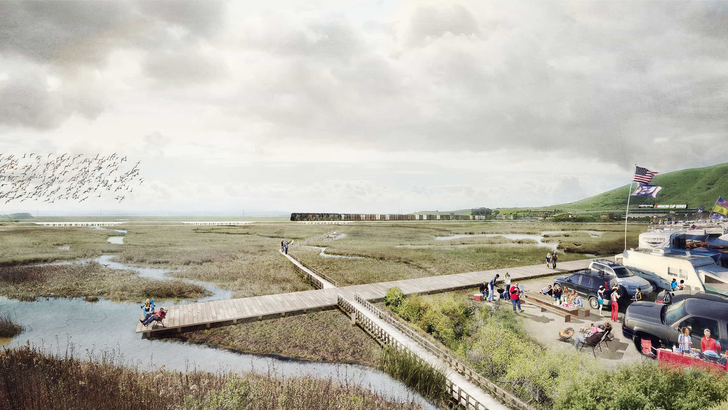
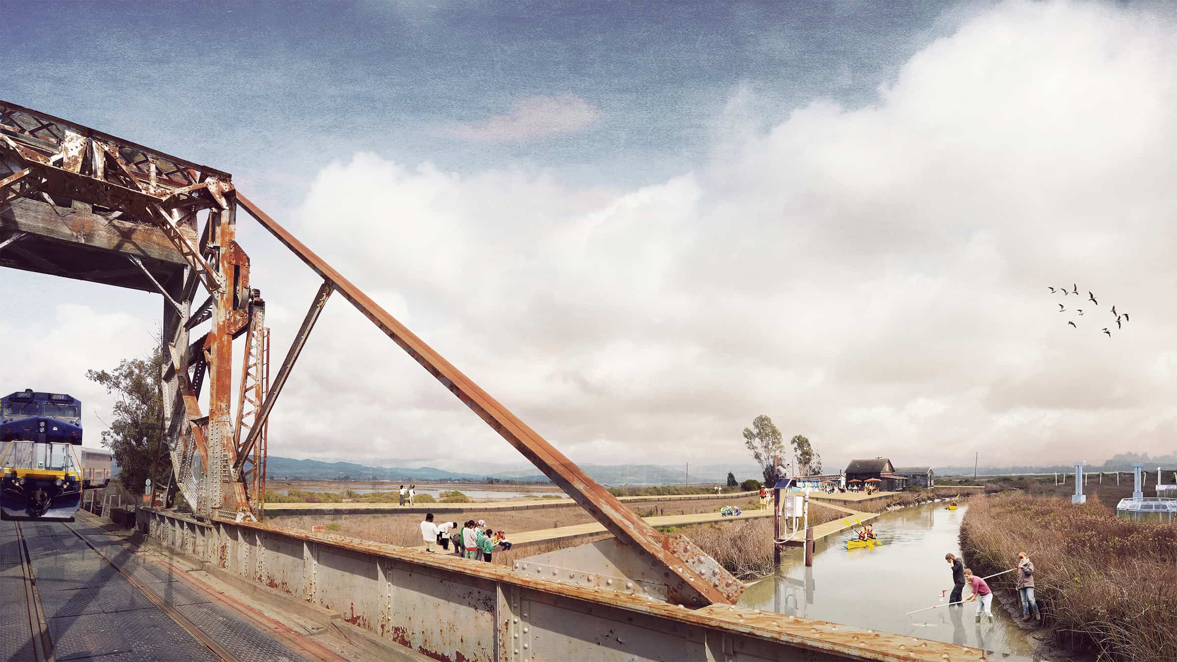
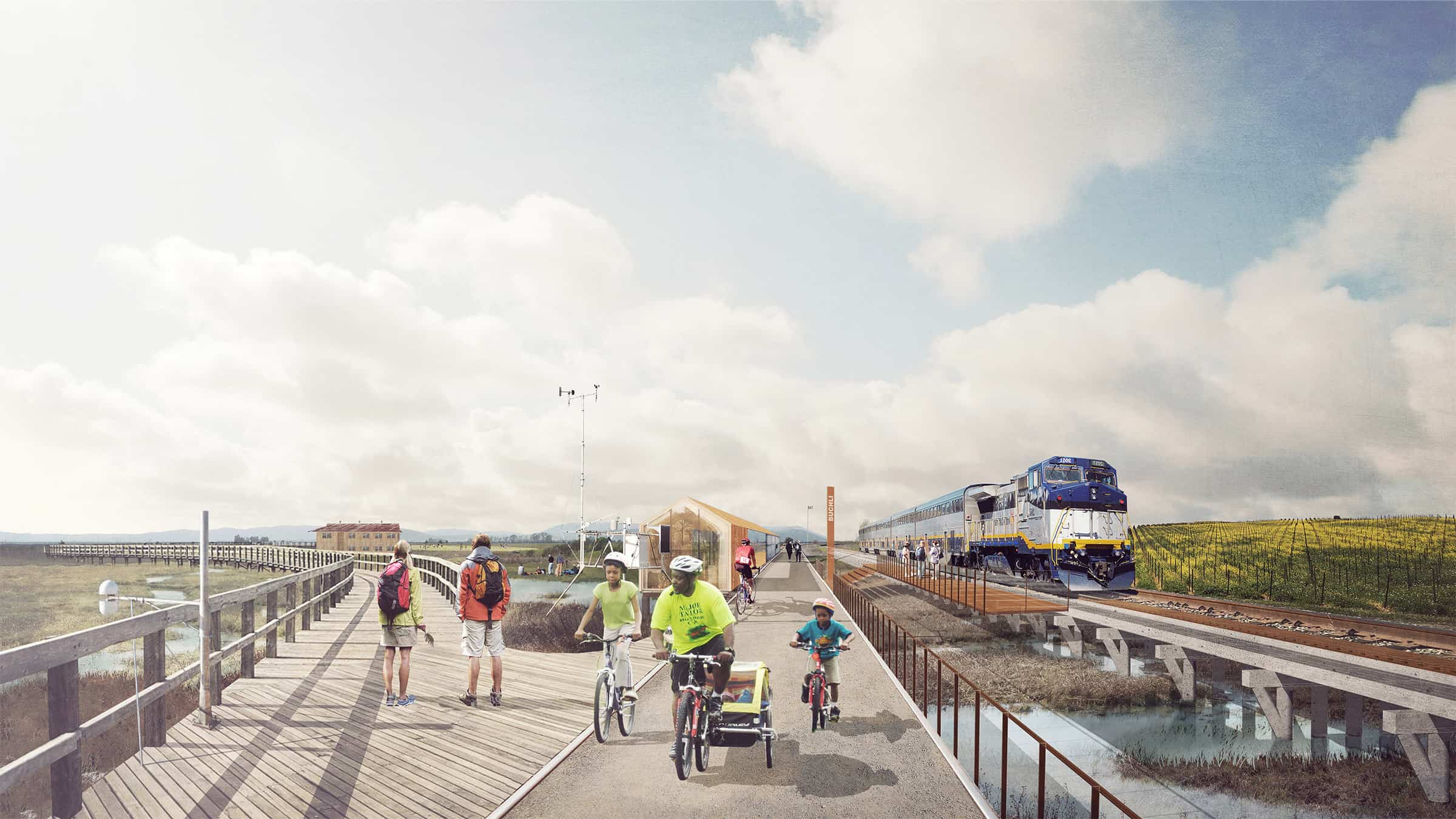
A great mobility loop will encompass the open space involving pedestrian and bike routes collocated with an excursion train using an existing freight line. Visitors will arrive at a variety of historic train stop ghost towns such as Buchli and Wingo, revived for cultural education using narratives of those who have lived with these lands in the past. The huge baylands complex is of course inextricably linked to the resolution of the highway. To prepare for rising sea levels, the project proposes to create an ecological laboratory working strategically with streams and diked sloughs to incrementally re-engage sediment deposits and cultivate biodiversity though various means including “sediment trains,” hyper-accretion gardens, and floating wetlands.
Common Ground Team
TLS Landscape Architecture (team lead) – Land Planning and Design
The Exploratorium, San Francisco – cultural / scientific artist
Michael Maltzan Architecture, Los Angeles – Infrastructure Design
Site Lab, San Francisco – Community Design and Public Outreach
HR&A Advisors, New York City – Economic and Governance Advisor
Rana Creek Design, Carmel Valley, CA – Terrestrial Ecology
Richard Hindle, Asst. Prof. at UC Berkeley – Shoreline Innovations and Patent History
Guy Nordenson and Assoc., New York City – Structural Engineering
Dr. John Oliver, Moss Landing Lab – Benthic Ecology
Lotus Water, San Francisco – Watershed Planning
Fehr & Peers, Oakland – Transportation Planning
Community Stakeholders
Greenbelt Alliance, Coastal Conservancy, Ducks Unlimited, Road Ecology Center, Transportation Authority of Marin, Sonoma County Transportation Authority, Napa Valley Transportation Authority, Solano Transportation Authority, Bay Trail, Water Trail, Sonoma Land Trust, US Fish and Wildlife, Caltrans, Metropolitan Transportation Commission


